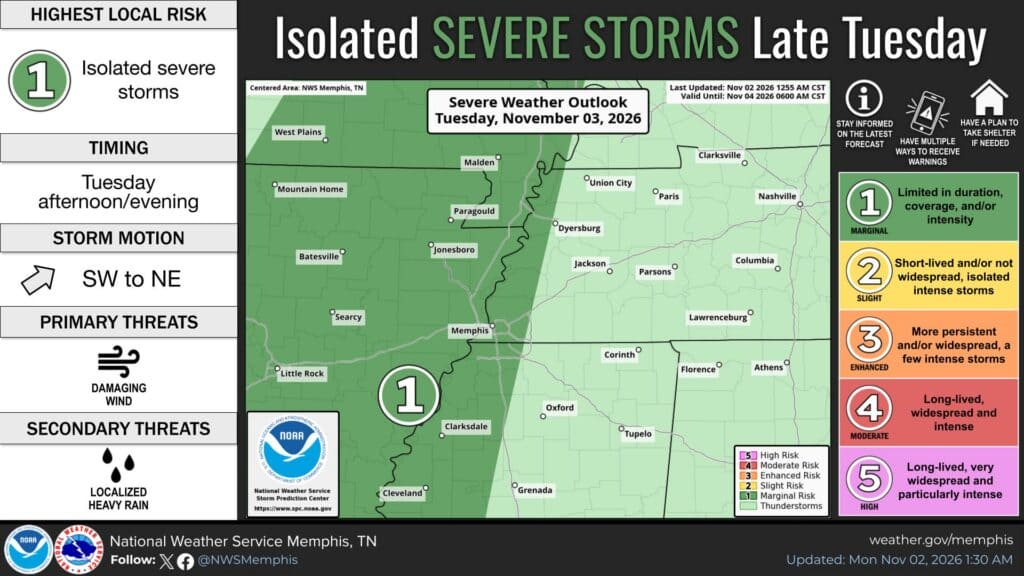
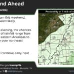
Here is our latest Election Day storm update for DeSoto County. If you plan to vote on Tuesday, Nov. 3, you’ll likely have the best weather in the morning and early afternoon. The National Weather Service in Memphis says a line of showers and thunderstorms will move in late Tuesday afternoon and evening, around the 7 p.m. poll closing. Heavy rain will continue overnight into Wednesday.
Election Day Storm Update: Timing for DeSoto County
Forecasters said Monday morning that Tuesday will start warm and windy, with highs in the upper 70s to near 80. The point forecast for the Southaven and Horn Lake area calls for south-southeast winds of 15 to 20 mph, with gusts up to 35 mph.
Morning to early afternoon (polls open at 7 a.m.): Mostly cloudy, windy and mostly dry.
Mid-to-late afternoon: Rain chances start rising after about 3 p.m.
Evening (polls close at 7 p.m.): Showers and thunderstorms become likely. The NWS hourly rain-chance table for nearby Memphis, Tunica, Oxford and Holly Springs jumps to 95-100 percent by 6 p.m.
Tuesday night into Wednesday morning: Showers and storms, some with heavy rain. Skies clear Wednesday, with a high near 71.
Severe Weather Risk Is Low but Not Zero
The NWS outlook places the Memphis area and parts of northwest Mississippi under a Level 1 of 5 (“marginal”) risk of isolated severe storms on Tuesday afternoon and evening. Damaging wind gusts are the main threat, and localized heavy rain is a secondary concern.
Monday’s forecast discussion said wind shear will be strong, but the atmosphere may not be unstable enough to support many severe storms. Forecasters said a strong storm or two capable of damaging winds or a brief tornado “cannot be ruled out,” but confidence in a severe outbreak is low. They plan to keep watching the setup over the next 48 hours.
1 to 2 Inches of Rain, Some Street Flooding Possible
The bigger concern for most of DeSoto County is rain. NWS Memphis expects 1 to 2 inches across the area, with a 40 to 60 percent chance that some spots south of I-40 top 2 inches by Wednesday. Forecasters don’t expect significant flooding, but heavy downpours could cause ponding on roads and localized flooding in low-lying areas during the evening commute.
Never drive through water-covered roads. Turn around, don’t drown.
Have more than one way to get weather warnings, such as a phone alert app or a weather radio.
If you’re voting after work, bring an umbrella and give yourself extra travel time.
Cooler, Drier Weekend Ahead
The front will move out quickly on Wednesday. More cold fronts late in the week will bring cooler air, and the NWS expects highs in the 60s and lows in the upper 30s to 40s by the weekend.