Tropical Storm Isaias Could Bring DeSoto County Rain Saturday
The Gulf disturbance forecasters were watching earlier this week now has a name, and it is expected to reach the Mid-South this weekend. The National Weather Service in Memphis said Wednesday that the remnants of Tropical Storm Isaias are expected to affect the region Saturday. DeSoto County could see 1 to 3 inches of rain and wind gusts of 20 to 30 mph. Until then, the weather will stay dry and unusually warm through Friday.
Where Tropical Storm Isaias Is Headed
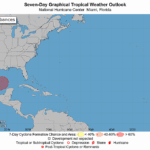
In its 10 a.m. Wednesday advisory, the National Hurricane Center placed Isaias over the southern Gulf, about 540 miles south-southwest of the mouth of the Mississippi River. It had maximum sustained winds near 45 mph and was moving east-northeast at 8 mph. Forecasters expect rapid strengthening and said Isaias should become a hurricane by Thursday before it approaches the northern Gulf Coast on Friday.
A Hurricane Watch is in effect from Bay St. Louis, Mississippi, to Indian Pass, Florida. A Storm Surge Watch covers the coast from the mouth of the Mississippi River to Yankeetown, Florida. Tropical Storm Watches extend west of Bay St. Louis into Louisiana and east of Indian Pass in Florida. The hurricane center’s forecast track brings the storm inland over Mississippi and Alabama by early Saturday, then northeast toward the Ohio Valley by Sunday.
What Tropical Storm Isaias Means for DeSoto County
The Memphis weather office said there is still “significant uncertainty” about the storm’s final path and strength once it moves inland. Its main concerns for the Mid-South are:
- Heavy rain: 1 to 3 inches is most likely, with lower totals to the west and higher totals to the east. Northeast Mississippi has a 30 to 40 percent chance of topping 3 inches, which would raise the flooding threat.
- Gusty wind: Gusts of 20 to 30 mph appear likely. Forecasters put the chance of gusts above 40 mph at less than 10 percent for the Memphis area.
- Timing: Most impacts should come during the day Saturday into Saturday evening, with leftover showers moving out Sunday.
- Severe storms: Any tornado or severe thunderstorm threat is expected to stay east of the Memphis forecast area based on the current track.
Because the worst effects are expected east of the Mississippi River, DeSoto County’s totals will depend on how far west the storm’s circulation tracks. Forecasters said that should become clearer in the next day or two.
Southaven Forecast
- Thursday: Sunny, high near 89
- Friday: Sunny, high near 90. Light rain possible Friday night.
- Saturday: Showers likely in the morning, then showers and thunderstorms likely. High near 78. East wind 10 to 20 mph, gusts to 30 mph. Rain chance 60 percent.
- Saturday night: Showers and thunderstorms likely, low around 62, gusts to 30 mph. Rain chance 70 percent.
- Sunday: Chance of showers before 1 p.m., high near 78.
Dry, seasonable weather with highs in the 80s should return next week.
Fire Danger Until the Rain Arrives
Afternoon humidity will drop to 25 to 35 percent through Friday, so use extra care with outdoor burning and equipment that can throw sparks. Residents with weekend outdoor plans should keep checking the forecast. It’s also a good time to clear storm drains and gutters and secure loose yard items before Saturday’s wind.
Related: DeSoto County Weather: Warm, Dry Week, Then Tropical Rain and DeSoto County burn ban status
Source: National Weather Service Memphis and National Hurricane Center