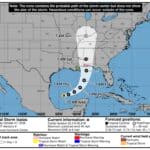
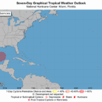
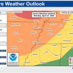
DeSoto County weather has two stories this week: poor air today and tropical rain by the weekend. A Code Orange ozone alert covers DeSoto County on Thursday, Oct. 8. Then the remnants of Hurricane Isaias, which reached hurricane strength Wednesday evening, are expected to sweep across the Mid-South on Saturday with soaking rain and gusty winds, according to the National Weather Service in Memphis.
Code Orange Ozone Alert for DeSoto County Today
The Shelby County Health Department issued a Code Orange ozone forecast for Thursday covering DeSoto County, Shelby County, Tenn., and Crittenden County, Ark. The National Weather Service relayed the alert, which runs through 5:30 p.m. Thursday.
Code Orange means ozone levels are forecast to be unhealthy for sensitive groups and above the federal health standard set by the Environmental Protection Agency. Health officials recommend that these groups limit long periods of hard outdoor activity today:
Active children and adults, including student athletes and outdoor workers
People with asthma or other respiratory disease
Ozone usually peaks in the afternoon on hot, sunny days with light wind, which is exactly the pattern in place now. Shifting outdoor practices or workouts to early morning can help. Residents can track current readings at AirNow.gov.
Dry and Warm Through Friday
Forecasters expect dry weather to continue through Friday, with highs from the mid-80s to the low 90s. Afternoon humidity could drop to 25 to 35 percent. Much of the Mid-South is in moderate to exceptional drought, so outdoor burning remains risky until the rain arrives.
What Isaias Means for DeSoto County Saturday
The weather service says Isaias’ remnant low will race north on Saturday. Most of the impacts should arrive between sunrise and midnight Saturday. Key points from the Thursday morning forecast discussion:
Rain: 1 to 3 inches is likely across the Mid-South, with half or more falling Saturday morning. Locally higher totals of up to 4 inches are possible over northeast Mississippi and near the Tennessee River.
Wind: Gusty winds are expected Saturday afternoon. Gusts of 35 mph or more are possible over northeast Mississippi and along the Tennessee River.
Flooding: The storm’s fast pace should limit flooding, but heavy rain on dry, hard ground can still cause ponding and street flooding. A Flood Watch is not planned yet, though forecasters say one may be considered later.
Tornadoes: A brief tornado cannot be ruled out, but the main tornado threat is expected to stay east of the Tennessee River.
Rain should move out early Sunday, and dry, warm weather is expected Sunday afternoon into the middle of next week.
How to Prepare
Saturday is a busy day for fall events, ballgames, and yard work around DeSoto County. Residents should check event updates, secure loose outdoor items such as decorations and trash cans before Saturday morning, and clear storm drains near their homes. Drivers should never go through flooded roads. The forecast could change, so keep an eye on updates from the National Weather Service in Memphis.