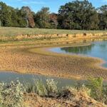
The DeSoto County drought has taken a turn for the worse, and the week ahead offers little help. The latest U.S. Drought Monitor map shows severe drought now covering about 92.5% of DeSoto County, while the National Weather Service in Memphis expects a cold front Sunday night to usher in a long stretch of sunny, dry weather.
Only a few light showers are possible late tonight and early Sunday, with rainfall amounts of less than a tenth of an inch expected. After that, the forecast calls for clear skies through at least Thursday.
Severe Drought Spreads Across DeSoto County
The U.S. Drought Monitor map released for Sept. 29 shows a sharp jump in drought severity across the county. One week earlier, all of DeSoto County was rated in moderate drought (D1), with none of it in the severe category. On the newest map, roughly 92.5% of the county has been upgraded to severe drought (D2).
Sept. 1 map: About 32% of the county in moderate drought
Sept. 8 through Sept. 22 maps: 100% of the county in moderate drought
Sept. 29 map: 100% in at least moderate drought, about 92.5% in severe drought
Severe drought typically means stressed lawns, pastures and crops, lower pond levels and a higher risk of grass and brush fires. The next Drought Monitor update is due Thursday.
DeSoto County Forecast: Sunny and Warmer Through Friday
According to the National Weather Service forecast for the Hernando area, here is what to expect:
Tonight: Mostly cloudy, a 20% chance of showers after 3 a.m., low around 65
Sunday: Early showers possible, then partly sunny, high near 80
Monday: Sunny and breezy, high near 80, low around 54 Monday night
Tuesday: Sunny, high near 82
Wednesday: Sunny, high near 85
Thursday: Sunny, high near 86
Friday: Sunny, high near 87, with a slight chance of afternoon showers
In its Saturday forecast discussion, the Memphis office said a “reinforcing cold front” late Sunday will end rain chances and bring a cooler, drier air mass. Cool, crisp mornings in the mid-50s will give way to warmer afternoons as high pressure builds, with highs by Friday running roughly 5 to 8 degrees above normal. Forecasters noted that computer models hint at a return of unsettled, wet weather next weekend, but that is far from certain.
Fire Danger Rises Midweek
The dry air behind the front is the bigger concern. The weather service said humidity levels could drop near 30% on Monday and Tuesday, with a medium-to-high chance of humidity falling below 30% on Wednesday and Thursday. Combined with drought-dried grass and leaves, that raises the risk that outdoor burning could get out of control quickly.
Residents can take a few simple steps this week:
Check with the Mississippi Forestry Commission and local fire officials for any burn bans before burning debris.
Avoid burning on breezy, low-humidity afternoons, and keep water and tools nearby if you must burn.
Dispose of cigarettes carefully and avoid parking vehicles on tall, dry grass.
Water new plantings and foundations deeply but less often to protect them during the dry spell.
Rain earlier this week brought only limited relief, as we reported in our earlier DeSoto County weather outlook. DeSoto County News will keep an eye on drought conditions and any burn restrictions as the week goes on.