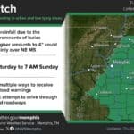
DeSoto County weather on Saturday, Oct. 10, is being driven by the remnants of Hurricane Isaias. The main worry is wind, not flooding. A Wind Advisory covers DeSoto County until 8 p.m. tonight, but the Flood Watch that had been posted for the county was canceled late Friday night as rain forecasts for the western part of the Mid-South came down.
Isaias made landfall on the Gulf Coast Friday evening as a Category 2 hurricane. In its Saturday morning discussion, the National Weather Service office in Memphis said the storm weakened quickly after it moved inland. Its circulation is expected to track just east of the Memphis area.
DeSoto County Weather Today: Gusty Winds Until 8 p.m.
The Wind Advisory, which the Weather Service reissued at 2:41 a.m. Saturday, calls for northeast winds of 15 to 25 mph with gusts as high as 50 mph across parts of north Mississippi, west Tennessee, east Arkansas and southeast Missouri. Forecasters warned that gusty winds will toss unsecured objects around, could bring down tree limbs and may cause a few power outages.
The point forecast for Hernando calls for:
Saturday: Cloudy, with rain showers likely after 8 a.m. and a high near 71. North-northeast winds of 10 to 25 mph, with gusts as high as 45 mph. Expect a quarter to half an inch of new rain.
Saturday night: A chance of showers before 8 p.m., then mostly cloudy with a low around 57. Gusts up to 40 mph are still possible.
Forecasters said winds could be stronger inside any rain bands that move through, but the timing of those bands is hard to pin down. The strongest gusts and heaviest rain are expected east of DeSoto County, toward Tupelo and the Tennessee River.
Why the Flood Watch Was Dropped
At 10:36 p.m. Friday, the Weather Service canceled the Flood Watch for DeSoto, Tate, Tunica, Panola, Coahoma, Quitman and Tallahatchie counties, along with Shelby and Tipton counties in Tennessee. Forecasters said guidance kept trending drier along the Mississippi River, and totals along and west of the river will likely stay under an inch. The watch is still in effect for counties farther east, including Marshall, Benton, Lafayette, Union, Lee and Alcorn, where 1 to 3 inches of rain is possible.
After weeks of dry weather, forecasters described the rain DeSoto County does get as “much needed.”
Storm Safety Tips for Saturday
Bring in or tie down patio furniture, trash cans, inflatable Halloween decorations and trampolines.
Stay away from downed power lines and report them to your utility.
Use caution on I-55, I-69 and I-269, where high-profile vehicles may feel strong crosswinds.
Charge phones and keep flashlights handy in case of brief outages.
Sunny, Hot Week Ahead
Isaias should clear the region by about midnight. Sunday turns sunny with a high near 86, and Monday (Columbus Day) and Tuesday should reach the upper 80s to near 90 under clear skies. The Weather Service expects dry, unusually warm weather through at least the middle of next week, with only a slight chance of showers by Wednesday.
The better weather lines up with Southaven Fallfest, which was moved to Sunday, Oct. 11, from 11 a.m. to 4 p.m. at the Field of Dreams parking lot, 6070 Snowden Lane.