A strong DeSoto County cold front will sweep through early Friday, Oct. 16, ending the run of near-record October heat. Forecasters at the National Weather Service in Memphis say it will bring gusty northwest winds, low humidity and elevated wildfire danger, then the coolest air of the season so far this weekend.
Two More Summer-Like Days First
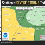
The heat sticks around a little longer. The NWS forecast for Southaven calls for a high near 90 today, Wednesday, with a 30 percent chance of scattered showers and thunderstorms, mainly in the morning and early afternoon. Forecasters said the best storm chances are north of Interstate 40, and heat indices across the Mid-South could reach the mid to upper 90s where storms don’t develop.
Thursday should be sunny with a high near 90 again. The weather service called it the area’s “last summer-like day” before the pattern changes. Drier air will move in Thursday, too, with dew points dropping into the upper 50s and low 60s.
DeSoto County Cold Front Timing and Fire Danger
The front is expected to move through dry early Friday because there is little moisture ahead of it, so don’t count on much rain. Here’s what the forecast shows for Southaven:
Friday: mostly sunny, with a high near 70 early and temperatures falling to around 65 in the afternoon. North-northwest winds 10 to 20 mph, with gusts up to 30 mph.
Friday night: low around 48, with north winds gusting to 30 mph.
Saturday: sunny and cool, high near 66.
Saturday night: clear, low around 45.
Sunday into early next week: warming again, with highs around 73 Sunday, 75 Monday and 79 Tuesday.
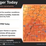
The bigger concern Friday is fire. The NWS said humidity could fall to about 35 percent Friday afternoon, and unlike the region’s recent low-humidity days, Friday will also bring strong northwest winds. That combination raises wildland fire danger.
Conditions on the ground make that worse. The most recent U.S. Drought Monitor map available, released for the week of Oct. 6, showed all of DeSoto County in at least moderate drought and about 92.5 percent of the county in severe (D2) drought. That map came out before last weekend’s tropical rain, and this week’s update should show how much that rain helped.
Safety Tips for Friday
Avoid outdoor burning Friday, including brush and leaf piles. Small fires can spread fast in gusty wind.
Don’t toss cigarettes from vehicles, and keep trailer chains from dragging, since sparks can ignite dry grass along roads like I-55 and I-269.
Secure lightweight outdoor items, including Halloween inflatables and decorations, before winds pick up Friday morning.
Check local fire department and county guidance before any burning, and call 911 right away if you see a grass or brush fire.
Cool Weekend for Fall Events
The Canadian air mass will settle in over the weekend with lighter winds, sunshine and lows in the 40s. That means jackets for Friday night football and weekend fall festivals, pumpkin patches and trunk-or-treat events. It’s also a good time to check the heating system before the first chilly mornings.
For the latest forecast, check the National Weather Service Memphis office at weather.gov/meg.