DeSoto County frost is likely early Sunday as the coldest air of the season settles over North Mississippi this weekend, according to the National Weather Service in Memphis. A reinforcing cold front moved through Friday, and forecasters expect overnight lows in the mid-30s Saturday night, cold enough for frost on lawns, rooftops and windshields across Southaven, Olive Branch, Horn Lake, Hernando, Walls and rural parts of the county.
The Weather Service says the coming cold snap will bring “the coldest temperatures since last spring,” with lows dropping below 40 degrees in most areas Sunday and Monday mornings. No watches, warnings or advisories were in effect for DeSoto County as of Friday afternoon.
DeSoto County Frost Forecast: How Cold Will It Get?
The NWS point forecast for the Hernando area calls for:
Friday night: Mostly clear, low around 41.
Saturday: Mostly sunny and chilly, high near 57 with a north wind of 5 to 10 mph.
Saturday night: Mostly clear, low around 36, with winds going nearly calm.
Sunday: Sunny, high near 62.
Sunday night: Mostly clear, low around 38.
Monday: Sunny, high near 66.
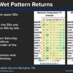
Clear skies and light winds are the classic setup for frost, so low-lying fields and rural spots outside the cities could run a few degrees colder than the official forecast. The NWS regional graphic shows Sunday morning lows of 34 in Tunica, 35 in Holly Springs and Oxford, and 36 in Memphis.
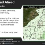
A hard freeze is not expected in DeSoto County. Forecasters said the best chance of a first freeze, about 50 to 60 percent, is north of Interstate 40 in West Tennessee, eastern Arkansas and the Missouri Bootheel.
Protect People, Pets and Plants
The Weather Service is urging residents to “make a plan” for people, pets and plants before Saturday night. Some simple steps:
Plants: Bring potted plants and hanging baskets inside, or cover tender plants with a sheet or frost cloth before sunset Saturday. Remove the covers once temperatures rise Sunday morning.
Pets: Give outdoor animals a dry, draft-free shelter and fresh water that won’t freeze, or bring them indoors overnight.
People: Check on elderly neighbors and anyone without reliable heat. Dress in layers for early outdoor activities and youth sports.
Heaters: If you are firing up a space heater or fireplace for the first time this season, keep heaters at least three feet from anything that can burn, plug them directly into a wall outlet, and make sure smoke and carbon monoxide alarms work.
Driving: Leave a few extra minutes Sunday morning to scrape frosty windshields.
Warmer, Dry Week Ahead
The chill will not last long. The NWS forecast discussion says below-normal temperatures fade next week as southerly winds return, pushing highs back into the mid-60s to low 70s. Little to no rain is expected over the next seven days, and forecasters noted that the dry stretch could raise fire danger by the end of next week, so residents planning to burn leaves or brush should check conditions first.
For the latest forecast, visit the National Weather Service Memphis office online. Earlier this week, DeSoto County drivers dealt with a dense fog advisory. If you’re shopping for a heater, see our guide to space heaters for cold mornings.